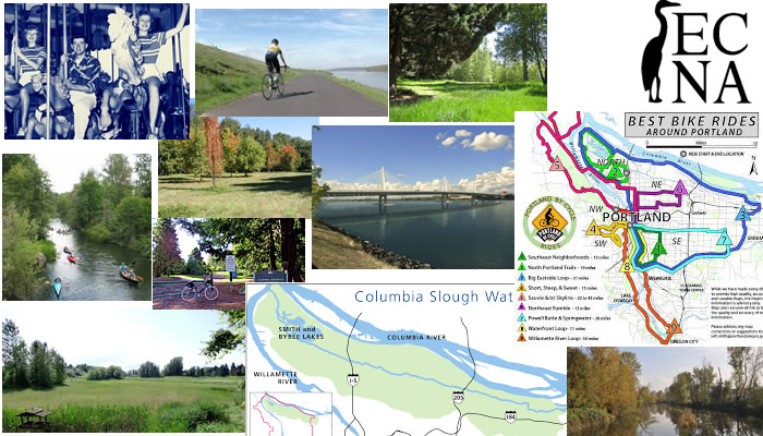
Here are pictures of the gorgeous wetlands, parks and trails found in the East Columbia Neighborhood in Portland.
East Columbia neighborhood runs along Marine Drive and the Columbia River, between 6th and 33rd. It is a very unique area due to it’s wetlands, the Columbia slough which runs through it, and the proximity of the Columbia River. You can still find farmland here, and large open fields and lots! The neighborhood is built over a lowland floodplain, but the site is managed so that flooding is no longer an issue. It is bordered by Bridgeton and Hayden Island to the north, and the northeast neighborhood of Sunderland to the east.
The area is very diverse and parts of it can be not very nice, if you are talking about the slum area down by Gertz Circle and other parts can be beautiful if you are talking about being on the river or in the surrounding farmland or the brand new high class Neighborhoods that are springing up. Or it can be in-between when you are in Mariners Loop area, which has pretty houses all squished together with tiny yards all out there by themselves really close to the river! I think this area will continue to grow and spread.
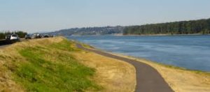
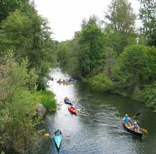 I love the wetlands here, the Columbia slough, the fields and open feeling, the wildlife and birds, and the River itself. There is a long trail that goes along the Columbia that is really fun to ride bikes on it goes and goes and goes and you can stop at little beaches on the way and lay in the sun. It’s a great area to live close to if you like the water. East Columbia neighborhood is a very unique due to its wetlands, open space and drainage ways combined with residential, industrial, and agricultural uses. East Columbia neighborhood is surrounded by 4 golf courses and bordered on the north by the Columbia River. It is also the closest neighborhood to the Airport, you can get there on Marine drive which barely ever has traffic, so if you fly very often, this would be a good place to live!
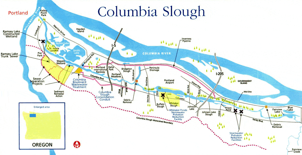
Here it shows the Columbia River Slough and Columbia River.
East Columbia neighborhood is on the edge of the 40-mile loop trail system, which really, when all added up, is a network of trails 100+ miles long. Trails run along the southern edge of the Columbia, through wetlands areas like the Smith and Bybee Wetlands in St. Johns and Forest Park across the Willamette. Because of the St John’s Bridge, these areas can all mostly connect! You are also surrounded by nature, everything from deer to eagles, hawks, and blue heron.
Parks in East Columbia Neighborhood
- The Columbia Children’s Arboretum is the geographical and social heart of East Columbia. Tall stands of cottonwoods hide it from sight, with a handful of paths and a gravel lane as its only access. Its 28 acres of trees, grassland and waterways provide a quiet home for deer, rabbits, waterfowl and many other animals. But on occasion, this park also hums with schoolchildren learning about nature or neighborhood potlucks on long summer afternoons. The arboretum’s heart is a 4.5-acre expanse of meadow edged with trees. Read more about it in the history part above.
- Delta Park
- Delta Park – Owens Sports Complex
History in East Columbia Neighborhood
 In 1900, the area along the Columbia River northeast of Portland was primarily farmland. It flooded every spring with heavy rainfall and melting mountain snows. In the dry summer and fall, water remained in shallow lakes and narrow sloughs. The land between the waterways formed great meadows surrounded by massive
 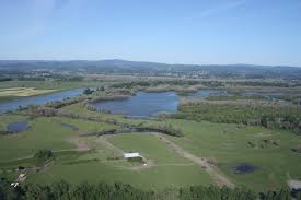 cottonwoods and other riparian plants.
John Charles Olmsted looked at this land with foresight. Although most considered it valueless for any other purpose than farming, he proposed acquiring a large acreage in the Columbia Slough region for future parkland. He wrote about the potential of this landscape as a contrast to the hills and river frontages in other parts of town to provide “. . . great stretches of meadow land bordered and diversified by groves of trees. No other form of park has ever proved so attractive and so useful to the masses of the people as the meadow park, particularly when there can be associated with it long reaches of still water as a landscape attraction and for boating purposes.”
Olmsted proposed that Columbia Slough Park would not only provide still waters for boaters unsure of the Willamette River’s strong currents, but also broad meadows for recreation such as picnicking, strolling, fast driving, horse racing (as long as gambling could be prevented), and golfing if it should retain its popularity. He suggested that the City secure hundreds to several thousand acres while this land remained inexpensive because of its regular flooding and its great distance from city development.
 The land Olmsted proposed for Columbia Slough Park surrounds Switzler’s Lake. Much of this land was farmed by a family named Delminico in the early 20th century. Along with other farmers in the area, they built the original levees between 1917-1919 to reduce yearly flooding from the river. By 1920, enough families had moved into the area that an educational facility was needed for the neighborhood children. Columbia School District #33 was
  organized and land was purchased for a grade school and high school along NE Sixth Ave. An elementary school was built on the property located at the corner of NE Sixth and Marine Dr. The high school property one block west, which was never developed, is now the Columbia Children’s Arboretum. The Columbia School District was annexed by Faloma District #33 in 1935, then reorganized as Columbia District #33 again in 1944. Portland Public Schools finally annexed the land and school in 1964.
When Portland School District acquired Columbia School, it was designated as a middle school, and to improve learning for the many disadvantaged students, they instituted a unique science program and the kids learned as they worked on the 28-acre site that became known as the Columbia Children’s Arboretum.
The land started out as a tangle of blackberries in 1965, but by 1970, students and families had planted 8,000 trees. Students began by planning three different scenarios for the development of the land. An orchard and organic garden was chosen for the area adjacent to NE Sixth Ave. An arboretum was designed for the land on the south side of the drainage ditch with intentions to solicit and plant trees from every U.S. state. The area furthest from Sixth Ave was planned as a natural area where indigenous plants and animals could provide a tranquil setting for study.
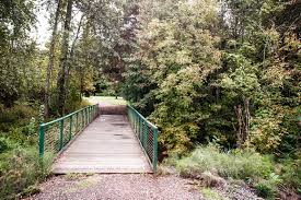
Childrens arboretum today
Before long, the creation of a garden and arboretum became a community project. Organizations of all sorts began to help the school create its dream. Bulldozers were brought in to remove the blackberries and create a pond with an island. The Oregon Association of Nurserymen supplied trees, the Rose Society donated roses for the garden, the pond was stocked with fish by the U.S. Fish and Wildlife, the Rotary Club provided tree labels, and the list goes on. The architect worked with students to design a study shelter that was adopted by Women in Construction. Remnants of the beginning of the shelter still remain, although its construction was limited by the fact that utilities could not be brought to the site.
In 1977, Portland Public Schools built a bus barn on the site of the organic farm area.
Eventually, changing demographics in northeast Portland reduced the need for Columbia Middle School, and it closed in 1983. Classes at Whitaker School, located three miles from the arboretum, adopted the GROW program in the 1980s and planting increased. However, the distance between the school and Arboretum became a problem and the program only lasted until the early 1990s. A few classrooms around the district continued to use the Arboretum for field trips. The most constant visitors were neighbors from the new housing developments on the east side of the Arboretum. The neighborhood association created a Columbia Children’s Arboretum Preservation Committee to develop goals and activities in the Arboretum. It has sponsored work parties on a monthly basis for over 10 years. In addition, the committee funded aspects of the East Columbia neighborhood Wetlands Management Plan to include plans for the Arboretum site. The very first Natural Resources Management Plan in the city, it has guided development and promoted the environmental activities for the Arboretum and adjacent areas since 1988.
In 1999, Portland Parks & Recreation acquired the Columbia Children’s Arboretum land from Portland Public Schools for use as a park. Working closely with the community, a management plan for the site was developed in March 2004.
Golf Courses
The East Columbia neighborhood is surrounded by golf courses:
- Heron Lakes Golf Course
- Portland Meadows Disc Golf Course in the neighborhood of Kenton
- Columbia Edgewater Country Club
- Riverside Golf and Country Club and Broadmoor Golf Course are farther to the east are and both in Sunderland neighborhood. Broadmoor is family owned, and has amazing views of the nearby mountains.
Other Important Links
Schools In Portland- people are permitted to send their children to whatever school they want within the Portland School District, as long as there is room. If the school is important to you, it is probably a good idea to check and see which school your neighborhood is assigned to- because it seems logical that the best schools will have a waiting list- and if you live there, you will be at the top! Find your school attendance area or a school site and view the boundary area using School Locator Page for: Portland Public Schools..
Read how to use the interactive map by clicking on the (Information) icon (circle with an
i in the center).
School Report Cards for schools and districts in Oregon. Select (Portland SD 1J) In the District Selection Heading to view individual schools within the Portland Public School District.
You can find all kinds of All kinds of information about crime, maps, etc, Portlandmaps.com even exactly what happened where, if you just put in an address in Portland. There are lots of other things you can learn there- like census information, maps, school info, parks, environmental issues, permits on houses, nuisance complaints and taxes.


")


